Walkable urban neighbourhoods – Freeing up potential for sustainable and active travel by improving walking and its connections with public transport
WalkUrban aims to better understand local accessibility and urban walkability in order to free up the potential for walking.
By exploring the links between objective, subjective and perceived walking accessibility the project identified key enabling and hindering factors for walking in various urban neighbourhoods. This was done in close collaboration with local stakeholders and citizens in the three chosen European cities: Genoa, Dortmund and Gothenburg. The ultimate aim was to provide local solutions to support walking as a zero-emission, sustainable and active transport mode in urban areas.
The project started in June 2021 and continued for 36 months until May 2024, with partners from Germany, Italy, Sweden and the United Kingdom.
For more information or to reach out, please contact us.
Three Cities

© comunedigenova
Genoa is the capital of the northwestern Italian region of Leguria. The transport planning prioritises walking and its connection to other sustainable transport modes within the local transport policy strategy.
Genoa as study area in WalkUrban
For more information about Genoa city
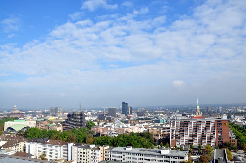
Dortmund is located in the west of Germany, in the heart of the Ruhr region. It is characterised by traditionally car-oriented urban planning and extensive car use, while the city has a good public transport system.
Dortmund as study area in WalkUrban
For more information about Dortmund city
© Stadt Dortmund
© Gbg1: “Gothenburg, Västra Götaland, Sweden” by pom’. is licensed under CC BY-SA 2.0
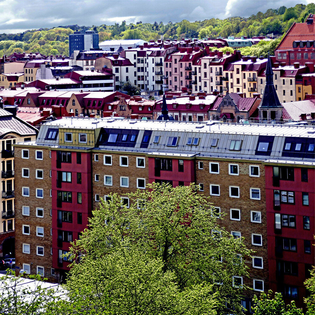
The city of Gothenburg, located in the south of Sweden, has a history of developing its urban planning around both public transport and cars.
Gothenburg as study area in WalkUrban
For more information about Gothenburg city
Mixed methods approach and policy implications
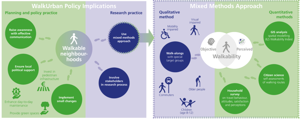
In each of the study areas respectively selected neighbhourhoods there has been a set of research methods empoyed in order to study different aspects of walkability in urban settings. A research framework was developed in order to facilitate our mixed-methods approach. Finally a set of policy implications was published, you can download them here
In each of the selected six neighbourhoods a set of methods was carried out to study urban walkability in a comprehensive manner. The WalkUrban project conducted different analysis and surveys as follows:
- First, there was a GIS-based accessibility and walkability analysis of each neighbourhood in relation to the built environment. With the help of a small-scale grid and detailed footpath networks, walking distances to various destinations such as bus and train stops, school locations or supermarkets are analysed. Parks and green spaces in walking distances are considered as well;
- Second, household surveys in local languages were conducted to gain insight into residents walking behaviours and attitudes, as well as the perceived walkability in different neighbourhoods;
- Third, citizens are asked to self-assess some of their own walking routes via a mobile app (Citizen Science Walking Route Assessments). It allows them to assess walking routes in their neighbourhood as they walk, including taking pictures of positive or negative aspects and answering questions about their walking experiences;
- Fourth, walk-along interviews have been carried out by researchers with individuals of the selected special target groups. We walk together in the neighbourhood, allowing the participants to talk freely and to point out things they like and dislike as they go. This qualitative data is primarily used to assess their specific needs and their perceived walkability and accessibility.
Publications
Our first WalkUrban paper discusses perceived walkability and was elaborated in parallel to developing our conceptual framework and prior to the development of our research methods. The paper is published open access in Transport Review, and can be downloaded here.
Determinants and effects of perceived walkability: a literature review, conceptual model and research agenda“.
De Vos, Jonas; Lättman, Katrin; van der Vlugt, Anna-Lena; Welsch, Janina; Otsuka, Noriko (2022): Determinants and effects of perceived walkability: a literature review, conceptual model and research agenda. In: Transport Reviews, S. 1–22. DOI: 10.1080/01441647.2022.2101072 ' fill='%235dd95d'%3E%3Cpath d='M 9.249787330627441 17.17169380187988 L 4.762476921081543 12.68437480926514 L 7.214956283569336 10.23189544677734 L 9.015677452087402 12.03262424468994 L 9.369227409362793 12.38618469238281 L 9.722777366638184 12.03262424468994 L 16.32264709472656 5.432744979858398 L 18.65010833740234 7.760213375091553 L 9.249787330627441 17.17169380187988 Z' stroke='none'/%3E%3Cpath d='M 9.249578475952148 16.46436309814453 L 17.94319725036621 7.760422229766846 L 16.32264709472656 6.139865875244141 L 10.07633686065674 12.38618469238281 L 9.369227409362793 13.09329414367676 L 8.662117004394531 12.38618469238281 L 7.214955806732178 10.93901634216309 L 5.469596385955811 12.68437480926514 L 9.249578475952148 16.46436309814453 M 9.249997138977051 17.87900352478027 L 4.05537748336792 12.68437385559082 L 7.214957237243652 9.524794578552246 L 9.369227409362793 11.67907428741455 L 16.32264709472656 4.725644111633301 L 19.35699653625488 7.76000452041626 L 9.249997138977051 17.87900352478027 Z' stroke='none' fill='%23fff'/%3E%3C/g%3E%3C/svg%3E%0A "In Citavi anzeigen") .
.
The conceptual framwork of the project was developed by the WalkUrban research team in the first few month of the project and can be downloaded below.
WalkUrban published a set of policy implications of the project
Stakeholder involvement
An important part of the Walk Urban project is our cooperation and work with partners in civil society.
The involvement of local stakeholders was continuous throughout the project research process. These stakeholders are e.g., municipalities and regional authorieties, schools and associations or interest groups. Recommendations given by the Municipality of Genoa at the first project meeting were implemented by each project group individually in the three case study cities, Genoa, Gothenburg and Dortmund. In each city, meetings have been held with different stakeholders on topics like the selection of target groups and neighbourhoods, method development, and approaches to involve citizens in our research activities. For detailed information see our study areas Genoa, Gothenburg and Dortmund.
Selection of neighbourhoods
In each of the three cities taking part in this project, two neighbourhoods were chosen as case studies where we will focus our research. The selection was based on a number of criteria which were defined by the WalkUrban research team at the beginning of the project:
- Size, the area should be walkable for its residents.
- Location, the area should be within the urban limits of the city, it should be in proximity to public transport links to the city (which should be accessible within 20 minutes) as well as within a max. 10-15 minute walk of points of interest and/or amenities such as schools, shops, leisure facilities.
- Population, there should be at least 5,000 residents in the area.
The similarities between the areas allowed for comparisons within and between them. WalkUrban aimed also for a selection of one ‘general middle-class neighbourhood’ in all three cities and, if possible, find a second, more diverse neighbourhood (e.g., regarding demographics, the built environment, or infrastructure). Based on an initial selection of 4-5 suitable neighbourhoods by the WalkUrban researchers, the final selection of two neighbourhoods was conducted in close collaboration with local stakeholders. For detailed information see our study areas Genoa, Gothenburg and Dortmund.
Funding agencies
This project is co-funded by four national funding agencies (BMBF, MIUR, SWEA with FORMAS and VINNOVA, ESRC) and ERA-Net Cofund scheme of the Horizon 2020 program.

MUR
Ministero
dell’Università e
della Ricerca


JPI Urban Europe
WalkUrban is a JPI Urban Europe project selected for the ERA-NET Cofund Urban Accessibility and Connectivity (ENUAC) call. ENAUC aims to create and test new solutions and approaches for achieving sustainable urban mobility. WalkUrban is one of 15 projects being successful for this call.

Approaches
WalkUrban Consortium and team members
ILS Research gGmbH
- Dr. Noriko Otsuka
- Anna-Lena van der Vlugt
- Dr. Janina Welsch
Municipality of Genoa
https://smart.comune.genova.it/
- Roberta Cafiero
- Paola Debandi
- Alessandra Vindigni
- Emanuele Mino